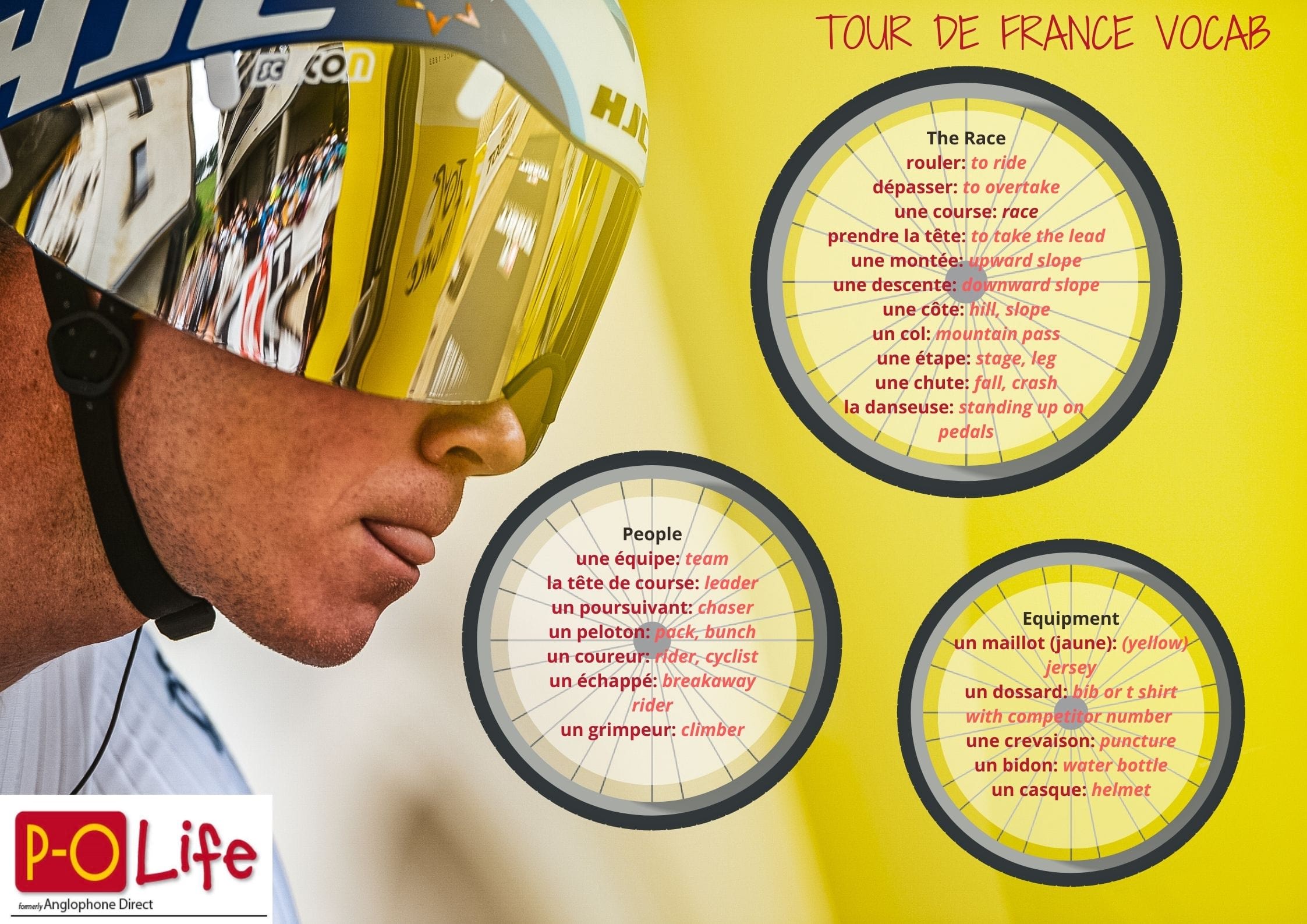
Tour de France 2026 Update
JUNE 2026: Stage 3 will cross from Catalonia into the Pyrénées-Orientales before a spectacular first-ever Tour de France finish at Les Angles.
The route is now officially confirmed and Stage 3 will indeed bring the Tour de France to Les Angles on Monday 6 July 2026. The riders will leave Granollers, near Barcelona, and tackle a demanding 196 km mountain stage into the Pyrénées-Orientales. (Tour de France)
After crossing the Pyrenees via the Col de Toses and passing through Puigcerdà, the peloton will enter France and climb through Font-Romeu, Bolquère, La Cabanasse and La Llagonne before heading towards the final ascent to Les Angles. (tourdefranceparcours.fr)
The stage features nearly 4,000 metres of climbing, making it the first real mountain test of the 2026 Tour and an early opportunity for the general classification contenders to make their mark. (Rêve de Vélo Events)
For Les Angles, this is a historic occasion, as the resort will host a Tour de France stage finish for the very first time. Local officials are expecting huge crowds and accommodation is already proving extremely popular for the race weekend. (Tour de France)
With a spectacular finish above the Lac de Matemale and the forests of Capcir, the arrival promises to showcase some of the most beautiful mountain scenery in the Pyrénées-Orientales to a worldwide television audience. (Les Angles)
This will be the first time in Tour history that Les Angles has appeared as a stage town, making it one of only ten new stage locations on the entire 2026 route.
JANUARY 2026
It’s still early – but we now have an official route for Stage 3 of the Tour de France, which will be Granollers (Spain) to Les Angles (P-O) and while the full detailed map with every small village isn’t yet published, there is enough information to give you a clear idea if you’re planning to be around the Pyrénées-Orientales when the Tour de France passes through next summer. 
🇫🇷 Tour de France 2026: Stage 3 — Granollers → Les Angles
🗓 Monday 6 July 2026
- Start: Granollers (Spain)
- Finish: Les Angles (Pyrénées-Orientales, France)
- Distance: approx. 196 km
- Type: Mountain stage with a high-altitude finish 
This is the first major mountain stage of the Tour, and it will be the first time the Tour finishes in Les Angles — a spectacular Pyrenean ski resort at nearly 1 800 m altitude. 
🗺️ Likely Route Through the Region (Unconfirmed this early in the year)
Here’s a good working outline based on the official stage profile and known climbs. Exact small-road traces will be finalised and mapped closer to race day (usually a few weeks before July), but this gives you a solid sense of where the race will go and where people can position themselves: 
🇪🇸 Spain to France
– Granollers (start) and then through Catalan foothills
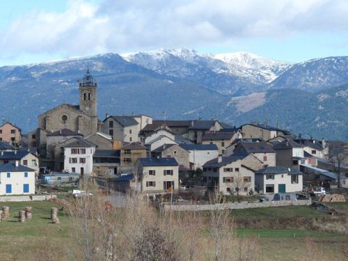
– Small towns such as Saint Feliu de Codines, Centelles, Vic and Ripoll (Catalonia) as the riders begin climbing toward the Pyrenees 
🏔 Approaching the Pyrénées-Orientales
•Planoles → Col de Toses (a notable climb near the Spanish-French border) 
•
Puigcerdà — at the edge of France, a traditional Cerdagne town near the border deep in mountain country 
🇫🇷 Entering the P-O
Once in France the route climbs toward:
– Font-Romeu — known for its altitude and training facilities 
– Col du Calvaire — one of the day’s higher points 
– Final ascent into Les Angles — where the finish line is set against panoramic mountain scenery 
📍 Key Places to Watch in the P-O
While the exact kilometre-by-kilometre route map hasn’t been officially published yet, based on the known stage profile and likely approach, here are good strategic spots for spectators around the Pyrénées-Orientales:
🥇 Les Angles
– Finish line — the best place to see riders complete the stage. Usually a festival atmosphere with screens, music and stalls 
🏞 Font-Romeu & Col du Calvaire
– These high-altitude points are dramatic vantage spots
– Great if you want to see the breakaways or climbing efforts
🏔 Nearby Areas Worth Considering
(Not confirmed but logically close to the line of travelEspace Cambre d’Aze
– Bolquère
– Station de ski de la Molina / Puigcerdà area (before the border) 
(Exact route maps with access roads and closures will be published official by
letour.fr weeks before the event.)
🗺️ Once the Official Map Is Out (Expected ~June 2026)
– Look for a detailed interactive stage map on the official Tour de France website.
– If you use mapping apps or GPX files, you can plan precise stopping points.
– Roads are often closed well in advance of the riders (sometimes hours before), so plan where you will park and walk to your viewing spot.
📌 Quick Tips for Watching the Tour
– Arrive early — crowds build fast, especially near the finish.
– Pack food, water and a folding chair if you plan to wait.
– Local navettes (shuttle buses) and park-and-ride services often operate on race day — check town tourism sites.
– Expect full road closures near summit finishes.
Related