WALK THE REGION WITH MIKE RHODES
Iglesieta de Vallserra
This super little walk takes place in the Capcir valley, near to Les Angles, and is suitable for all the family as it involves minimal height gain and, subject to weather, can be done, summer, winter and also on a mountain bike.
The walk as described can be done in either direction and is aprox 13k and without breaks takes between 3 & 4 hours in summer. If done in winter conditions make sure of a good snow cover as some parts do get icy. In good snow conditions this will take several hours longer.
As a family VTT route it will take 1 ½ – 2 hours and needs only a basic mountain bike. These can be hired at Fougues VTT. In summer, walking shoes will suffice but do take food and water as none is available on route unless you return via Balcere.

The start point is at the popular parking spot at the Club L’Oursan/Restaurant at Lac de Matermale. GPS co-ords- 31N426010E 4714058N at 1540m and the high point 1705m when crossing the Serrat del Frare.
To get here take the N116 from Prades to Mont Louis and then the D118 towards Formigueres. After 15 mins you will see Lac de Matermale on your left and at the 2nd Matermale sign, turn left and follow signs to the lake. Map Font Romeu IGN 2249ET covers this area in 1/25000.
From the car park take the path NNE, besides the road, for 500m to the Fougues VTT hire building, turn left and in 100m turn right to join a wider track, the Voie Royale which in the Middle Ages was the main road crossing the Capcir valley.
This track runs straight for 800m until you come to the road which is crossed with care. Continue ahead on the Voie Royale for another 1800m with great views to your right of Le Madres. Turn around and you have equally great views of Cambre D’Axe.
The more “Eagle Eyed” will have noticed that we are following a VTT route no 6, so keep an eye out for the small signs which will take you to the left to cross the main Les Angles Formigueres road.
Just across the road take a track to the R which leads to another wide track in 250m. Signs take you straight across and a good track takes you in another 1500m around Formigueres to a camp site.
Turn left before the site and climb for 100m to a track alongside a canal. Follow the canal to the right for 800m to a track which climbs gently to the left for another 1500m through the forest.
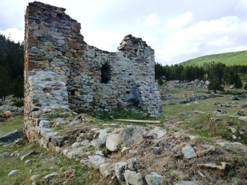
Here we join a wide fire track and signs point to the right to Les Iglesiettes and Lac Balcere. Take a note of this path junction as we will need to return here later but follow the track for a few hundred meters, across a small bridge and the ruined remains of the Eglise Santa Maria come into view.
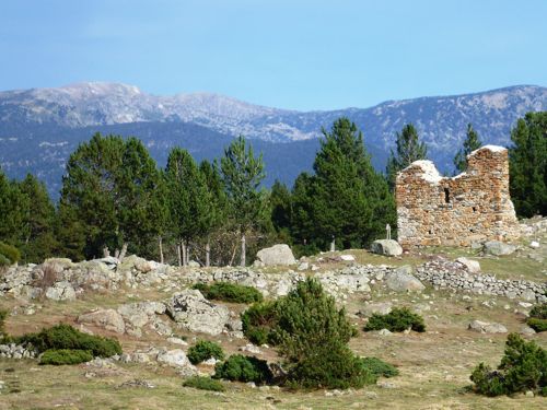
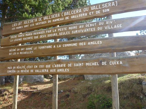
The church was the focal point of the now ruined village of Balcere or Valserra which was decimated by the black death in the 14th century. The story is that, after the plague, the only remaining survivors were two sisters and they donated all of the land to the commune of Les Angles!
Around the church you can see the remains of the old houses and land boundaries. Work has been going on recently to clear bushes and trees to find out more information about this era
A few hundred meters further on there is the ruins of a lime kiln which was still in use up to the 20th century to provide mortar to the local villages. Looking up the valley, the ski slopes of Les Angles are visible. The area around the church is a perfect picnic spot on a nice day in this sheltered valley.
My route retraces its steps but it is also possible to return by several different routes including following the signs to Lac Balcere, where in summer there is a café and a navette will take you back to Les Angles and a 30 min stroll back to the lake.
Our route however returns to the junction taken earlier where an unmarked track veers to the right. Do not take the track directly up the hill but the one contouring gently to the left.
This comes out after 1k on another fire track. Turn to the left for 100m and follow a vague track to the right, through an electric fence and down 350m to cross another fire road, descending through the trees to the Formigueres road. Cross over and follow paths to the right, marked for Lac de Matermale which will be reached in another 2k.
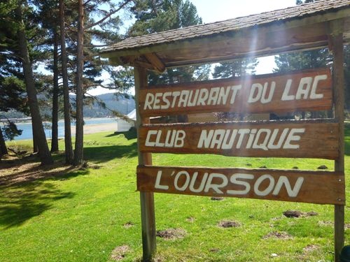
The café/restaurant by the lake is a perfect place to recuperate with a cold beer. In summer Lac de Matermale is a major outdoor activity centre with water sports and one of the best high ropes courses in the area. Perfect for all the family.
Summer or winter there is a good chance of seeing red deer, marmottes and in the afternoon perhaps sanglier. In winter the snow cover will show the tracks of all of these animals and more. The area by the ruined church is a popular grazing area for both cows and horses in high summer.
This is my favourite version of the walk but many options are available so take your map and enjoy a superb day.

